Thursday, October 29, 2009

Log of September 12, 2008

Friday Sept 12, 2008

George was woken early by the Burnt Coat fishing Coop members heading out to work. So he started our charcoal fire so that it was nice & cozy by the time we got up around 7. We remembered the fantastic anchoring techniqwue of Schooner Heritage which came in last night just before sunset.

9:15 We dropped our mooring around[?] & headed East through the exhilarating channel heading to Somes Sound. Then we raised the main & unfurled the jib to head North going W of the Sisters Islands. The tide was ebbing so the current was against us. We sailed between Beach Is. & Placentia where, interestingly, there was little current.
Then we turned East between Little Gott & Black & there was a strong fair current even though the tide was still ebbing. We saw a porpoise or two here in the swirling currents.
Then we bore off for the Western Way, the wind was S, it was building, we went fast! By the dime we got to S. unker lLedge we were doing 7 knots with main & a bit of jib.
We did reef when we were closer in to SW Harbor. We toured around in SW Harbor & saw Kay Evans' families' summer house w/ the real estate sign in the yard. Then we headed on into Somes Sound--arriving at Valley Cove around 2:30. The cliff was impressive but with rain threatening it seemed bleak so we determined to continue on to Somes Harbor [Somesville]. We did note the plaque on the cliff wall at Valley Cove dedicated to the donors of the land to the public in the 19th Century.
We passed the Williams boatyard with a remarkable 8 meter and a nice red Rosinante. The wind continued to be very strong from the SW. We arrived in Somes Harbor ~3:30 and anchored on the SW end getting some shelter fron the trees. Just then the rain started so we had tea inside. While having tea we spied a charming pair of loons who were friendly to each other near us.
George & Betsy zodiaced to the dinghy dock and walked for provisions (right) & to the bookstore (left).

This was a great day. All new territory for North Wind and lots of interesting sights along the way. It was high water as we came out the little tickle North of Harbor Island, so that wasn't as dramatic as at low water, but the passage around Black Island was spectacular. Then in the building Southerly, we had a rousing sail up the Western Way and, after our fly-by of SWH, it continued on up Somes Sound. Somesville was a lovely snug destination and we managed to find a good protected spot to anchor under the lee of Mason Point and just clear of the mooring field. Beautiful place to be sheltered on a windy, foggy, rainy afternoon. Made our warm dry cabin a very cozy place to be.

Log of September 11, 2008

Thursday, Sept. 11--

Beautiful morning. Sailed off mooring at 7:35 in the light NE breeze. Sailed about 40 min & then motored due to light headwind. Our goal is points E entered by Deer Isle Thoroughfare.
Our plan for the next couple of days is to sail East to Somes Sound so we can get Betsy to a plane out of the Trenton airport around noon on Saturday. We hope to make our way to Burnt Coat Harbor on the south side of Swan's Island tonight.
After rounding Webster Head & Oak Hill, we bore away and gave a try to the spinnaker with Lisa on the sheet. This was ~9:45 or so. Lovely time without the motor but progress was minimal. The current is S but we didn't get very far E.

11:00 Snack & give up on spinnaker.

11:20 Started motor and headed straight toward buoy off Deer Isle Thor.

11:35 Passing red nun, entering Stonington.

12:25 Sailing (!) as West breeze has filled in. Taking new route (for us) through islands (Little Camp, Potato, etc).
Stonington was lousy with schooners. Victory Chimes, Am. Eagle, Nathaniel Bowditch & 3 others in sight/anchored nearby. Lobster boats enjoying speeding past near us so we can feel big wake.
Nice watching Heritage coming to anchor at McGlathery as we headed past toward Colby Ledge before heading East to Toothacher Bay & Burnt Coat Harbor.
This was a really fun spur of the moment detour. We were sailing past Stonington in a light westerly and as we came past Scott I. the half-tide rock to the west of it was clearly visible, making it easy to reach past and head south there. I put up the helm and we threaded our way down through the islands. Much more enjoyable than running slowly through the rest of the Thoroughfare.

1545 In the harbor touring around having sailed in and lowered sail.
Picked up a green rental mooring (#4) belonging to "The Boat House". Then ashore to the Coop to leave $20 for the owner and take a short walk.
There seems to be a good anchorage just east of the mooring field. Heritage came in at sunset and did a lovely job of a flying anchor over there. The chart doesn't show much water, so it bears careful investigation.

1645 Back aboard for tea. Boat names in this harbor: Atonement, Emanuel, Prince of Peace, , Fifth Day, Fortunate Son, Bread of Life, Sparrow, Daily Bread, Trial by Fire, not to mention, Monkeys Uncle, Busy Bee (with yellow & black trim) & Rughless, Daddy's Helpers & Belinda B.
Note--while in the Fisherman's Coop we found the jar for donation to rebuild the burned Swan's Island Library (which Lisa was seeking) and she made a donation.

Wednesday, October 28, 2009

Log of September 10, 2008

Sept 10

6:30 Beginning to stir. Wind came NW in the night as expected. Clear, COOL.

7:15 Drop mooring. Heading by motor to Castine YC for showers, then to Cast. Variety for provisions. Pancakes will be 1st thought.

10:30 Casting off town dock after shower + provisioning. Heading around Turtle Head. Suiting up w/full foul weather gear due to surf spray & white caps.

12:30 Rounded Turtle Head having motor/beaten with bouncing strong NW wind 15-20 knots. Finally able to bear off a bit & turn off motor.

1:00 Heading for mainland shore where we will bear off further & head for Gilkey. Hopefully, this more sheltered course will allow for lunch.

1:30 Under west shore, south of Belfast, running out the West Bay--Soup & sandwiches and views of a very attractive bold shore.

2:00 Entering Gilkey Harbor - running fast through and out the south end - no seals hauled out on the ledges today. Cut across to the East Bay between Lasell I to the north and Saddle to the south and a fast broad reach across to Pulpit.

3:30 in Pulpit, dropping sail.

4:00 On a purloined mooring further in than usual. Then short walk ashore, cocktails, etc.
Walk included harvesting a few apples and a wild flower centerpiece. Chicken Fusion then bed.

Today and yesterday we experienced the passage of a very powerful front and its aftermath. It has been really interesting weather--an extreme example of what we see all the time as warm humid weather is replaced with cooler, drier air by the passage of a cold front. In this case, the tropical air following Hanna has been exceptionally warm and unstable with a really strong cold front bringing up the rear and returning us to seasonable temperatures. Happily, we have been in sheltered water with flat seas and good anchorages, so it was really an exciting show and not much to worry about.

Tuesday, October 27, 2009

Log of September 9, 2008

Sept 9 - Tuesday

8:00 Enjoying muffins in the cockpit admiring the loon diving for his breakfast nearby. Nice SW breeze. Lovely sunshine.

9:30 Weighing anchor heading N. perhaps to Holbrook. Expecting a storm later. Single reef. Headed East out the Fox I. Thorofare then NW past Scrag & north between Horse Head & Colt Head. Tucked in second reef.

1240 SW of Cape Rosier - thunder squall - thunder, lightning, strong WSW wind, torrential rain - struck mizzen & rolled up 1/2 jib. Headed 015M @ 5 1/2-7 1/2 for passage S of Holbrook I and a HIS mooring in Tom Cod Cove.

1345 Tom Cod Cove. Squall is past, leaving light rain & a moist S'westerly.

1500 A Cape Dory 36 picked up the other HIS mooring close aboard. Shortened up on the mooring pennant & made a bridle from two looped dock lines. Riding better

1650 Still misty-moisty. Wind is up and down from SW.

2000 D&Ss, wonderful pasta feed & Valmissine Pinot Noir. We can see the clear sky to the west as the back end of the front approaches us. Short shower.

This was one of the wildest weather days we have had. In many respects more dramatic than Hanna. Taken together, it has been a really dramatic few days. But between the big events, it has been quite nice. The boat has taken good care of us throughout.

Monday, October 26, 2009

Log of September 8, 2008

Monday Sept 8

7:00 Glassy calm morning. Beautiful cool clear weather.
Set out promptly, motoring to BBY to p/u Lisa & Doc.

8:15 Breakfast on the dock in Center Harbor.

8:45 Set out for North Haven

9:40 Set out again for N. Haven having returned for forgotten luggage.
Motor sailed most of the way to be sure to get the 3:30 ferry (which Ryck & Jenn needed to catch).
Had hoped that the SW breeze would turn southerly but it didn't. Route we took was down Jerrico Bay & thin Stonington for a scenic flyby. Tied up in N Haven around 3 at the Casino YC. Were able to buy ice but little else except some muffins for tomorrow morning and a chart placemat for general amusement.

4:30ish (16:30) headed for Perry Creek with crew of Lisa, Doc, Betsy & George. Anchored further in than usual having taken advantage of the high tide to explore safe locations.

5:30 Enjoying wine and snacks in beautiful setting. Blue yawl, blue ketch & trimaran for company. No mosquitoes.

6:30 Getting chilly, still no mosquitoes.

During wine + snacks we was a wonderful aerial engagement between a bald eagle and an osprey. When we first saw them, the eagle was in hot pursuit of the smaller bird, both of them twisting, diving and jigging. Doc got the binoculars on them in time to see that the osprey had a fish in his claws. The eagle bore down and snatched the fish away and soared away. The osprey in hot pursuit.

This was a bit of a rushed day, between doubling back in the morning and the wind not cooperating. But despite all, it worked out well, with a lot of good scenery, a look around North Haven village, excellent company and finally ending up in Perry Creek. For the record, my memory is that the fish dropped into the woods and neither bird ended up with it.

Sunday, October 25, 2009

Log of September 7, 2008

Sunday Sept 7
0800 Wind backing more North after blowing from the East in the night. Rain has stopped & the clouds are getting higher with patches of blue, but none yet big enough for Dutchman's Britches. We are hoping to run down into the Reach later today, perhaps to Benjamin River.

10-10:30 Hoisted anchors after extensive work the full twists out of the 2 anchors. George retrieved anchors in reverse order of setting.

10:30 Departing Smith Cove noting other vessels struggling with tangled anchor rodes or, in the case of one large wedding cake yacht, attempting to untangle chains with thrusters, twin screws and cursing (he finally appeared in the Castine channel two hours later.)

11 - Tied up at Castine town dock. Drained 6" of water from the dinghy, refloated it & put outboard back on. Also, bought NYT and provisions. The rain of the prior night did a fabulous job of power washing North Wind's cabin top and side decks (although by nightfall they were all muddy again.) Lunch at the dock.

1:00 [aka 1300] Sailed single reefed from Castine in a strong NW breeze. Made good time past Cape Rosier in sparkling conditions. Turned East for Egg. Reach and did a scenic fly-by of Bucks Harbor.
Emerged from Bucks, famished at 3:30 and had 3:40esis aka 20 of 4'sis or 1540esis. Sort of like tea but with no tea.

5:15 In Benjamin River after a leisurely sail in the Reach, the wind having gone light. With Betsy at the helm we missed the awesome ledge by a safe margin aided by the peak of the tide.

* Anchored at the far N edge of the mooring field.
Enough breeze that we could have Dark n' Stormys in the cockpit while keeping mosquitoes at bay.

We managed to have the aftermath without ever really getting the storm. Best of both worlds, really. The rainfall was dramatic.

Castine, Smith Cove, the water around Cape Rosier and into Eggemoggin Reach are my childhood sailing grounds. Beautiful waters with great sailing and a ton of great destinations. Despite this, I have only been into Benjamin River on rare occasions. It was poorly marked when I was a kid, but it is an easy place to get into now with a crowded mooring field. Nice spot, but not a secluded one, by any means.

Log of September 6, 2008

Saturday - 6 Foggy morning, slow morning.

1110 Underway with 1/4 mi visibility for Castine. All plain sail. Light Sotherly - scaled up off Seal Cove - lots of good misty views of the Camden Hills. Rounded Turtle head & into thick o' fog in East Bay. Scaled up near the Castine Bell.

3:05 Tied up at Castine YC. Ran into old friend/shanghaied by David Bix to go see Peter Tenney at Peter's niece's big roast wedding (Ryck + George).
Betsy & Jenn toured the town on foot.
Early lobster at Dennett's Wharf.

6:30-7:40 - Anchoring at Smith Cove in rain. Set claw first to windward. Then the regular anchor. Spot was far SE corner behind Sheep Is.

7:55 Break out eh booze, chashews, raisins & music.
-awaiting Hurricane Hanna remnants

8:15 Hanna!! Tropical rain has arrived big time.

9:55 Listening to Hard Hearted Hannah on iPod.
Overnight--heavy rain and gusty wind, but nothing extreme. We lay under the hill to the east in quiet water. We ended up lying to the claw without incident.

This is about the best spot I know for a hurricane hole. but then again, it is my childhood stomping ground, so I'm sure there are lots of other good spots around. We were in there with a wedding cake power yacht, another cruising boat and what looked like a good size Alden ketch. We were closest under the bluff and had a very quiet night. If it had come on to blow hard from the west I would have preferred to be a bit further off the bricks.

Log of September 5, 2008

Friday, 5 Sept 08 - Light easterly & early clouds dissipate. Variable & Sunny.

0845 Underway, motoring to Rockland for provisioning & crew change.

1045 Alongside Knights Marine. Water & 22 gal Diesel (for ~37 hours motoring at

1700rpm) Marked stick & suspect it is a 25 gal, not 30 gal, tank.

1145 Along side town dock to change crew--Betsy arrived, Ryck & Jenn near.

14:10 Leaving dock in Rockland, heading to Warren Island/Gilkey.

1540 Fog rolled in--headed for Gilkey hbr 065M/3.75nm 4.5kts.
Fog has lifted--New slogan for the Pine Tree State, "Maine--Lousy with schooners."

16:30 Sailing past the Ensign Islands, a sweet passage up to Gilkey.

1800 (aka 6) Pick up Warren Island mooring under sail to the amazement of the sober(?) people on the shore.

This was the start of a fun short cruise with Ryck and Jenn which had a little bit of everything in the way of weather. The fog was in and out during this afternoon and we were listening to reports of the approaching tropical storm Hanna on the radio. We have been to the anchorage behind Warren Island a couple of times. Perhaps we will get ashore on the state park one of these days. It certainly seems like a nice spot.

Log of September 3 & 4, 2008

Pleasant night @ anchor in P-town
Good sky, tasty provisions, etc.

0530 Anchors aweigh, bound out & north.

0830 42° 07.0 N/70° 25.2 W GW taking over from Doc. Making good ~225/5kts.

1255 47° 17.98 N/70° 20.54 W tacked to Stbd.
By dawn the breeze was moderating and we set out with hopes of making better progress than yesterday. As we got out and clear of Race Point, the waves were still impressive, but not quite as short as the day before. But with two big wave trains crossing, some were very big and steep. Every now and then we would fall off a big one. And I think it was one of these which broke the mizzen mast step, a problem which showed up over the next few days, but was only properly diagnosed by the yard crew at Brooklin Boat Yard after the boat was hauled.

Later we learned that Steve White had been in the same area that day in Vortex, his Swede 55, and had broken the main bulkhead falling off one of these same transient cliffs.

As we came back inshore toward Cape Ann on the starboard tack, the seas calmed down and it became clear that we were going to be able to make good progress if we kept going overnight without exhausting ourselves. The wind was moderating as well.

1527 42° 28.7 N/70° 31.6 W Set Mizzen & unrolled jib--Left 1 reef in main. Wind veering so we are able to make good ~355M.

1555 Stopped engine--Making 4.5 kts+ under full sail.

1700 Back under power. Londoner on the Port Bow. Making good about 030M/5kts.

1955 42° 47.5 N/70° 22.7 W ~058/4.6kts.
GW 5:30-8:30; Tom 7:30-10:30; Doc 9:30-12:30
GW 11:30-2:30; Tom 1:30-4:30; Doc 3:30-6:30
GW 5:30-8:30; Tom 8:30-11:30; Doc 11:30-2:30
Motorsailing in a light easterly. About to heat Chili for dinner-clear sky sliver of a moon.
There are two variables I tinker with when setting up watch schedules on these deliveries. One is watch length and the other is overlap. In this case, I set three hour watches and had us stand one hour alone with an hour overlap before and after during darkness, with a full three hours alone during the day so we could catch up on our sleep. Sometimes I stretch the day watches to four hours, but that seemed as if it would be tedious this time.

2030 Breeze died - dropped sail & increased rpm to 1700 to maintain ~4.8 kts.

2314 42° 59.3 N/70° 08.4 W; 055M/5kts. motoring, sails down.

0024 Thursday Sept 04, '08. 43° 03.4 N/70° 02.5W; 055M 5.5kts.

0134 43° 07.7 N/69° 57.1 W 055/5.0kts Tom just cam on & reported a possible pee bucket emergency, which turned out, happily, to be a false alarm.
The pee bucket reference will be obvious to anyone familiar with North Wind. She is equipped with a composting head. It works well, but does require the pee bucket be emptied quite often.

0326 43° 14.4 N/069° 48.4W 050/5kts.

0430 43° 19.12 N 69° 43.68 W 050/5kts
light S wind fill in?

0526 43° 22.4 N/ 69° 40.6 W

1040 Monhegan ~4mi on the Stbd bow.
Sunny, hazy, warm morning. Light westerly, but not enough to sail.

1050 New course 055M for Whitehead I.

1145 Set sail jus W of Monhegan's N end.
With the afternoon ahead of us and a nice sea breeze filling in, we turned into day sailors and looked for a pretty route through the islands rather than just following the shipping lane up the bay. The added advantage was that it got the light breeze onto our quarter and the boat came alive.

1500 After setting sail we headed between Burnt I and Allen I, turned west to go south of Davis I and then back E. through Davis Straight. We then "followed the cable area" [Curtis & Rindlaub] into the mouth of Port Clyde & then continued out past Mosquito I. before turning n. toward the mouth of Tennants. Now we have gybe & are carrying a perfect 10 kt breeze down onto Whitehead I and the Muscle Ridges on a stbd tack. We are considering holding on for Pulpit if the wind holds.

1628 Exiting Fisherman I Passage bound for Pulpit. 060M ~5.8kts.

1900 Anchor down in Pulpit--the usual spot--Nice run over at about 4-5kts against the ebb. Impressive clouds, but no rain or big wind shifts. All is well. Dark & Stormys all around, salad & chili to follow.

23oo To bed, having solved the problems of the world.

A nice ending to a somewhat boisterous delivery with a lovely afternoon sailing through the islands and ending up in a favorite destination. The "usual spot" is straight in to about 16 feet of water a little beyond where the schooners anchor.

Log of September 2, 2008

9/2 Weighed anchor @ 0550, departed Parker's B.Y. @ 0645 with Tom G., Doc & GW. North wind, clear, tide fair in the canal. Bound for Rockland, ME.

0755--Entering Hog I. Channel.

0915--Boats ahead at East Entrance turning back & warning of rough seas & "20-30 kt winds." We set double reefed main & turned to buck the current while we battened down. Then...

0940 Snuck out the red side of the East Ent. Not too bad considering. Wind ~North 15-20 kts. Worked our way to Mizzen, double reefed main & 1/2 jib. Seas ~4 ft. out of the canal current.

1030 Set watch schedule: 9-12 Tom; 12-3 GW; 3-6 Doc; 6-9 Tom; 8-11 GW; 10-1 Doc; 12-3 Tom; 2-5 GW; 4-7 Doc. We will decide later if we will go overnight or shelter for a few hours.

1049 41° 49.5 N/70° 23.5 W. Making good ~080M 6kts.

1152 41° 52.0 N/70° 16.3 W.

1405--Setting course for P'town.

1445--Wood End abeam.

1535--Anchor down at the east end of the P'Town breakwater.
ESCAPE BEARING 160M
This was a rugged day. There had been a gale sitting offshore for days which was sending big lumpy seas in from the East and fairly strong headwinds. So we butted our heads against these "square" seas for the twenty-some-odd miles across Cape Cod Bay and were happy to pack it in with plenty of time to have dinner and a good night sleep before trying again the following day. With her shoal draft and buoyant ends, North Wind doesn't like short seas and strong headwinds. Her very middle aged crew has a limited tolerance for futile discomfort.

Log of September 1, 2008

September 1--Lewis Bay to Maine!

The Party consists of Betsy & George for the day sail to Red Brook Harbor.
Sunny, Breezy NW--Cool Canadian high. Loaded perishables, unshackled the mooring pennant & dropped away.

0930 underway with one reef.

1000 At the channel mouth-set course of 240M to pass west of Horseshoe Shoal.

1018 Hodges Rock abeam to Port 245M to Wreck Shoal Buoy 4.5 nm ahead.

1110 Wreck Shoal Bell to Stbd, R10 bears 260M, 2nm then C11 2nm.

1135 Bell 10 to stbd. Changed course for North Channel 290M to GR Can, ~1nm ahead.

1330 West end of North Channel--Headed for Nobska Pt close hauled Stbd--have been down to reefed Main & scrap of jib, but now full jib & somewhat under powered.

2:15 Entering Woods Hole--current running fast.

2:25 In Buzzards Bay!
This is a fairly complete, if sparse, log of a typical run from Lewis Bay through Woods Hole. It starts out with a bit of a harbor hurricane at the mouth of Lewis Bay, then out through the shallow and somewhat rock-strewn waters to the south of Hyannis. As we pass west of Horseshoe Shoal and approach the main shipping channel, the wind changes and the tidal current becomes a major factor. We decided to go north of L'Hommedieu Shoal in this case, but there is really no escape from the current which runs well over two knots for several miles. The difference between a fair or foul current amounts to something like a difference of five knots over the ground--nothing to sneeze at.

Typically, the wind was quite different on the other side of the Elizabeth Islands.

2:30 Motoring in light air from N. Breeze strenghtened, continued to motorsail up the Bay, then N around Basset's I.

5:25 Tied up at Parker's in Red Brook H.

2010 Anchored off Bassett I in 12 ft--still air. At Parker's we met Doc & Betsy left in his truck. We bought 4-5 gal of Diesel & a couple of blocks of ice. Then Doc & BW motored to anchor just at sunset. After a glass of wine & some cheese, we came to the awful realization that there was no oil or butter or Soy sauce on board, dimming the hopes of a chicken stir fry. We made do with oil siphoned off the Balsamic Vinaigrette salad dressing. Also, the water filter is on the fritz. So things are not off to a smooth start from a culinary perspective. Perhaps the food situation will be brighter in the morning. Anchored off Bassett's Isl.

We are becoming regulars in the anchorage off the east side of Bassett's Island. There is a nice lead of water just the right depth--about 10-14 feet with good holding and it is not far from the dock at Parker's for crew changes and such. Very secure and convenient for our needs.

Friday, March 6, 2009

Log of August , 2008

August 4 2008
The party consisted of: Denise Hebert-Finnigan (Ann Arbor via Kentucky), Margaret Lansing + Ken Ludwig, Capt George Whitehead
Departed 14:00ish Calm + Sunny, out the channel, inspected the Maya.
Then out towards the daylight, returned w/ threatening skies, rain on the horizon--"Jesus Step", dry + happy, we broke a block underway. Returned: 16:25

Nice relaxed sail in light air. The stud up from the mounting plate for the main sheet block on the port side of the cabin top inexplicably broke clean off in light air as we sailed back in. The temporary repair was to use two of the bolt holes to secure a spare block with a lashing. We used this successfully for the rest of the season.

August 9 10:30-2:15 pm
Party: George & Betsy, Kenzie and her friend Erin, Leland and his friend Rachel, Amanda and Gabriel, Cousin Dwight Lansing and son Timothy (The all novice crew :)). Pleasant sail to Hyannisport and back to Egg Island for a swim.
August 10: George & Betsy set sail ~11:30. Destination: Cape Wind Test tower.
12:45 Beating out past Bishop & Clerks near Hodges Rock.
1538 At the data tower 41-28.4N/70-18.9 W/25 ft of water.
18:13 Having run/broad reached back, made perfect sailing mooring pickup, to applause from wooden sloop on next mooring.
This was a delightful sail.  What with all the family activities, Betsy and I only manage to get a couple of days of sailing together in the summer.  The weather was great and we just had a nice relaxing day.  We make a habit of sailing on and off the mooring when possible; it is good practice in both senses of the phrase, so it was vaguely embarrassing to get applause from the folks in the next mooring for doing what we do all the time.
August 15--Afternoon sail--Peggy & Bruce, Betsy & GW. Out to near Bishop & Clerks in comfortable afternoon S'W;erly, then back, into Uncle Roberts Cove and home.
August 17--Ted, Leo, Kerry & two friends of hers & GW. Blowing 25 kts. Double reef & a scrap of jib. Reached around the Bay for about 1 hr and then to the cove to anchor & swim.
Aug 19 Tues--Breezy Southerly--Thunder squalls forecast for early afternoon. 10 am to Egg I for a swim. The crew consisted of Ema, Ted, Leo, Ty, Betsy & GW. Set Jib & jigger & beat out to the (E.) end of Egg I. Anchored 15 feet off the island. As we were getting the anchor the engine shift cable broke with the transmission in fwd. Got the anchor, shut down the engine and sailed out & back to the mooring. Moored by 1130, front swept through ~1300, back out on the mooring to remove the cable by 1430. Showers ~1630 while sharing a beer with Ziggurat (Finisterre look alike).
This is the last entry for August. After that I replaced the shift cable, cleaned the prop and got ready for the trip down east with fuel, water and supplies. We did some more local sailing during the last couple of weeks and were eager to get to Maine.

All summer we had seen the storm clouds streaming past only a few miles to the west of us, but on Lewis Bay it had been a fine season.

The owner of Ziggurat, son of the man who had sailed this famous S&S design around the world, borrowed our copy of the Maine cruising guide and set off for points east. The weather was breezy while he was gone. He reappeared about ten days later having gotten to Plymouth and then thought better of the long stretches of open water lying ahead to be covered single-handed. I was relieved, since the weather had been quite brisk and unsettled while he was gone.

We had a good crew lined up and were looking forward to heading out at the end of the month. We just needed some good luck with the weather.

Log of Saturday, August 2, 2008

August 2--Make & mend. July 11 to the end [of the month] was mostly consumed with shore-side family activities. On July 11 & 12 we took family members and wedding guests on day sails. On July 13 we took three separate groups on sails. By the end of the day the breeze was mid 20s, gusting to ~30 kts and we were happy to have a double reef in the mainsail. Then later in the month we took several sails/picnics/swims with the family. The engine has behaved fine with the new filter--plan to change it again before heading down east. The mooring pennant jumped out of the chock a week ago and roughed up some of the woodwork but I did a bit of a sand & paint job. Other projects, freshen paint below. Get & install LED tricolor & anchor light. Install Deck light. Repair lock tongue. Dabs of paint here & there. Check prop & clean before heading East. Re-rig lazy jacks to be able to run them fwd. N.W. is generally in fine shape.

As of late the following winter, the to-do list in this entry is partly done. I have re-painted much of the cabin white paint, installed the replacement deck light, the lock tongue, cleaned the prop. I still need to get LEDs for the masthead lights, re-rig the lazy jacks and do various other bits of bosunry.

Log of Thursday, July 10, 2008

July 10--Replaced Racor filter @ 870 hrs. Ran for 1/2 hr + under load with no problem, so hoping its OK.

This was my first day back from Alaska and there were a lot of things to do for Geo and Deirdre's wedding. But happily for me, one of the things on the agenda was to have North Wind available on Friday and Saturday as local entertainment. So I had a built-in excuse to head out to the mooring and set things to rights.

The engine hours were 802.5 on the first Friday of June in Maine after about 12 hours under power, so we have logged about 80 hours under power this season thus far.

Friday, February 13, 2009

Log of Sunday, June 22, 2008


Sunday, June 22 - overcast, damp, Southerly ~5-8 k. Destination: Lewis Bay from Sippican.

I had been listening to a forecast of foul winds with unstable and deteriorating conditions, so on Saturday afternoon I called Tom and asked him to come earlier so we could get some miles under our keel and be sure to make the tide in the Hole.

I wasn't enjoying reunion much except for a good long discussion with my classmate Phin Sprague in which we failed to solve many of the pressing problems of our age. He and I differ greatly in our political outlook and we had a good time exploring the terrain. He also drew me a great little sketch of the Richmond Island anchorage just South of Cape Elizabeth. I look forward to trying it out soon.
0930 underway with Tom Gels & GW


1010 Converse Pt. abeam to Stbd. Closehauled Stbd tack under Jib & Jigger making good 174M @ 5 1/2 kts
Tom is a good local pilot for the upper reaches of Buzzards Bay, so he was calling the shots on how far we beat out the west shore before crossing over. It was blowing somewhere in the high teens and the forecast was for more later, so I was glad to be making tracks. We continued motor sailing to get to windward as fast as possible before the chop got too bad.
1036 - finished a hitch on Port to Pease's Point & back to Stbd. for the Hole.
At some point the wind eased and we raised the main. Then we started to labor a bit and I tucked in a reef. North Wind likes to sail on her feet, like most beamy centerboarders, so she was much happier after that.
1230 In Woods Hole - Engine quit while beating out Buzzards Bay - expect fuel starvation - so sailing through.

We were over on the East side of the Bay when the engine quit. My best guess was that the Racor filter just got clogged up with crud after a couple of days of bouncy Buzzards Bay seas, so I didn't worry too much about the machinery. And since we had a fair breeze through the hole and on out the Sound, I thought it was better to keep sailing than to stop and play mechanic.

We blasted through Woods Hole in fine style. It is fun to sail through and I always think of my father's story about visiting a member of the Forbes family on Naushon Island and, together, beating through Woods Hole in a six meter against the tide. That must have been some time shortly before WWII; it remained a favorite memory of his.
1315 hitting 9.8 kts on the GPS as we reach for the west end of the Hedge Fence with the current under us.
The tide runs hard through here. In many ways it is more important to have a fair current in the Sound than in the Hole; the current isn't as strong, but the distance is much greater.
~1340 Ryck calls to report a squall cell over Chilmark headed our way - we drop the main & suit up.
Oh, the marvels of modern technology. We had a weather eye peeled and things looked pretty murky to the south so it was great to get a timely heads-up from Ryck who was trying to get some work done, but was actually sneaking a peek at the weather radar and daydreaming about sailing.

We dropped the main and were all suited up in our foul weather gear by the time the squall line came through. Between our preparations and it losing some punch as it crossed the Vineyard, the squall wasn't much of a problem, but it was wet and windy and visibility dropped to almost nothing for a few minutes.

We cleared the East end of L'Hommedieu Shoal and bore away for Lewis Bay.
1455 R "8" Wreck Shoal abeam, squall long gone--non-event thanks to Ryck. Raise main with single reef. 057M for the Hyannis Channel 6.5 NM ahead.
Perfect timing; this was slack water almost to the minute. We had carried a fair current up to now, and as we put Wreck Shoal astern, we left the fierce currents which made Geo. Eldredge's fame and fortune and entered a part of the Sound where the currents are minimal.
1600 Entering the Lewis Bay channel--Spindle abeam to Stbd, R"4" to Port.
As we came up the channel I was putting things to rights and getting ready to leave the boat. After putting her on the mooring, I was flying to Alaska to join cousin Phil for two weeks of salmon fishing in Bristol Bay--a totally new experience for me--and then returning just in time for my stepson George's wedding. So it was going to be a long time before North Wind got any TLC again.
1715 Rigged mooring pennant by anchoring to windward, rigging pennant from Zodiac & then transferring to the mooring.
The final challenge was to rig the mooring pennant. The float was in place with the chain coming up through the center of it. We had to remove the shackle, put on the pennant and reconnect the whole thing. We did it by rounding up to windward, dropping the hook and then, after dropping back, bringing the Zodiac alongside and futzing with the gear from the Zodiac. It worked fine, but another time I might try to pass a temporary pennant and then work from the Zodiac while moored rather than anchored. Especially if I could approach under power!
1740 Cleaning up & getting ready to go.

1810--Loading out--the voyage is over.
A very successful two week cruise. Thanks to all the friends and family who took part and made it so enjoyable.

Log of Friday, June 20, 2008


Friday, June 20 - Clear & Sunny - Light Westerly
Canal transits are, of course, entirely controlled by the current. While tugs with tows push through against the current, and fast motorboats don't much care, we must pick times of fair current if we are to make much headway at all. In this the tide was to turn fair around mid-day, so we planned to catch the first of this ebb to speed us on our way.
0700 up anchor N. of Clarks I. & out the unmarked channel - again at dead low. Spoke to the owner of the Island Packet who had proceeded us in and anchored in the same area. He grew up in Colonial Acres and will be back in Lewis Bay this weekend.
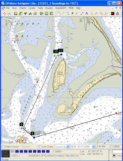
The anchorage was a magical spot; steeped in history and currently an exclusive summer enclave, Clarks I. has the wonderful feel of an isolated outpost against the sea while being within a short distance from bustling Plymouth, Duxbury & Kingston. Ryck's photo shows the anchorage at the North end of Clarks I. astern as we motor out. What you don't see in a picture is how we are in a narrow navigable channel in a huge bay clogged with sand banks and shoals.
0820 Approaching the mouth of the channel & the Gurnet - will shortly turn South for Manomet and then the Canal.
This was the first day of summer for lots of Massachusetts schools and it was fun to see many lobster and other fishing boats with kids on board to enjoy the first day of freedom.
0825 Pass out @ Duxbury Bell #1 New course 160M, 6NM to Manomet whis.
1131 Entering Canal

~1300 Cleared rr bridge

1415 Cleared Hog I. Channel & bore away on Port tack ~285M
This last entry glosses over a poor decision by the skipper and a resulting very uncomfortable 45 minutes. To understand the problem, you have to know what everyone who transits the Canal learns quickly; The fair current Westbound runs head-on into the summer Southwesterly funneling up the Bay, resulting in big square waves in the Hog Island Channel.

As we cleared Mashnee Island, Tom suggested we flop over onto starboard tack and leave the shore to head East to the old canal channel under Wings Neck. That is a little longer, but gets out of the current and some of the wind. For whatever reason, our pig-headed commander said no and we continued out the channel to take quite a beating before we cleared the Stony Point Dike and bore away on Port for Sippican Neck and Bird Island.
1500 Centerboard Shoal drawing abeam 350M for Ram I.
1530 Arrived Sippican Harbor and moored to #83.

The rest of the story, which can be imagined from Ryck's slides, has us finding our way ashore, registering for Tabor reunion, making ourselves somewhat respectable for somewhat polite company and having a nice dinner with our significant others under the reunion tent before going our separate ways. Thank you shipmates!

Tabor has a lovely and active waterfront and it is always fun to see how they take increasing advantage of their location to enhance their educational program.

My plan was to stay until Sunday when Tom had agreed to rejoin me for the final leg of the voyage to Lewis Bay. I thought it would be good to stay through the chapel service to remember Phil Smith, a classmate who had died since last reunion. That would leave scant time to make the tide through Woods Hole, but I was hoping for the best on that score.

For the moment, I was just happy to be ashore and showered and having a meal with friends without the flashlight in my back pocket and all the responsibility that symbolizes for the cruising sailor.

Thursday, February 12, 2009

Log of Thursday, June 19, 2008

Thursday, June 19 Awoke at 0600,

Click image for slide show

after pancakes and coffee,
lifted the hook at 0705. toured the inner Rockport Harbor and headed out for Plymouth (or alternatively P-town). Temperature 62 F, light winds out of the south, partly cloudy--a beautiful day with unfavorable winds. Motoring.


I really wanted to go to Plymouth and anchor behind Clarks Island where the Mayflower spent the winter after arriving with the Pilgrims. Both Ryck and Tom were familiar with the channel and so this seemed like a perfect opportunity to work in there with some local knowledge on board.

0815 Londoner abeam to Starboard.
0934 42-32.8 N/70-34.3//4.1k@210M
1045 Boston Skyline visible ~22 miles distant.
Breeze died - turned from ~200M to ~225M expecting the breeze to fill in SW later. Trying to motorsail when the wind allows.


1110 Spoke to Rob Hurd G17 <=> G21 #83 is our mooring.
Rob is the Waterfront Director at Tabor. He had arranged a mooring for us in Sippican Harbor off the Tabor dock for the weekend and this was just confirming where we were to go when we arrived.
1135 Warned off the LNG deepwater port by a work boat on station --put in GPS.

Stumbling onto the new LNG deepwater port was a navigational embarrassment. I knew perfectly well that this facility had been installed, but had looked at the rhumb line from Midcoast Maine and the Canal, had assumed that we would be well offshore and hadn't given it another thought. In fact, the facility lies right between Cape Ann and Plymouth and our course took us right through the area.

As we approached, we were on course to pass close ahead of a sizable workboat, I watched carefully for a bit and realized she was not underway so decided it was OK to cross her bow. I took the precaution of monitoring VHF ch 13 and 16; the boat came up on the radio and let us know what was going on. We were going between the two hookups to the pipeline, which were marked only by polypro pickup lines. We offered to tack away, but he said it was fine to go through so long as we stayed away from the actual pickups.
1202 42-20.7N/70-37.4W. Plymouth bears 190M distant 20.6 mi. Wind light & variable, generally Southerly & trying to establish a sea breeze. Sunny & comfortable in the cockpit.
This was a pleasant afternoon, only marred by the necessity of keeping the diesel humming a lot of the time since we had quite a distance to cover to windward if we were to get to Plymouth at a reasonable hour.

Spent the afternoon beating to Plymouth.
1800 Weathered the Gurnet & entered the channel with a bone in her teeth. Sailed up the channel & dropped sail just West of the S. end of Clarks I. then motored to the North end to anchor among the untenanted moorings. The key to the unmarked channel is to come in at about 035M and headed to the left end of the vegetation on the beach ahead.
The finish was great. We swept into the entrance channel against the last of the ebb with a reef in the main, rounded the bug light and up the channel toward Clarks Island. The photo, by Ryck, shows Tom at the helm as we leave the Gurnet astern and slip by Browns Bank. Finally, we rounded up and dropped sail before the channel split and narrowed west of the island. When we got to the anchorage area, it was rather full of empty moorings and it was a bit of a trick to find a clear spot, especially since we didn't know the limits of the surrounding shoals. Happily it was low water, so if we were afloat, we were OK. So we poked around a bit and anchored near an Island Packet which had come in shortly before us.

1930 Anchor down & holding. Paul is again looking for the missing bottle of wine.

While Paul tried to solve one pressing mystery, we had our last dinner aboard and looked ahead to the morrow, when we would transit the Canal and, we hoped, arrive at Tabor for "cocktails under the great tent" and an arrival dinner with Betsy, Mary and Jenn, who would be meeting us. Ryck and I would be staying on to attend our reunion.

Wednesday, February 11, 2009

Log of Wednesday, June 18, 2008


Wednesday, June 18 Proverbial first light appears somewhat behind schedule, 0415 or so, owing to heavy overcast. Fish jumping in cove.
This was the big day of the trip. We had that long, inhospitable stretch of coast to put behind us and still a long way to go to be in Sippican Harbor on Friday. The weather forecast continued turbulent, with thundershowers and gusty winds. But it was calm, dreary and damp as we made final preparations and got underway.
North Wind stows dinghy engine & gets underway @
0515 bound SW w/goal: Isles of Shoals. Visibility 1/2 mile under low ceiling.
0606 Turned SSW at Outer Green I. Thick o' Fog.
0705 Cape Elizabeth on the Stbd bow distant 1.3 nm visibility a scant 2 nm. Making 4.4 kts against a foul flood current. Paul on the helm, Tom at lookout & Ryck is cooking toast. BW is naviguessing. ETA at Gong #2 is ~0730.
For a while the fog shut down tight, we sounded the required sound signals and made securite calls as we crossed traffic lanes. We heard a couple of lobster boats working in the distance and, on the radio, one tug underway in the inner harbor, otherwise everything was still.

=>Watch Schedule for the day: Tom 6-10; Ryck 8-12; Paul 10-2; GW 12-4.
Even tho' this was just a long day, I tried to treat it as a passage with watches and regular log entries. It was too long a day to let someone carry an undue share of the load and there was certainly a chance we would end up underway overnight, since there is really no place to hide along the way.

0805 43-29.59 N/070-12.37 W -- 4.7 kts, vis good.
0905 43-25.50 N/070-15.47 W 4.5 kts OK 1-2 nm.
1050 43-20.94 N/070-17.66 W Sky clouds purple [?], Scale up 5+ vis
1205 43-11.9 N/070-20.75 W 4.75 kt, 4 mi NE Boon Is.
1218 43-10.8 N/070-21.2 W 4.5 kts Boon Id light on Stbd bow 6 mi distant--Sunny, clear, thunderheads astern, light Southerly. Minky (?) whale breached a few minutes ago.
Not much literary value in the log entries of this day. In the late morning, we emerged from under the heavy overcast and could see thunderheads to the North and West over the coastline as the unstable air was roiled by the sun. But for us it was a pleasant day only marred by the diesel and the headwind as we strove to make the best mileage we could.
1330 Hoisted main and jib. Making 6 kts at 230 deg.
Though the log doesn't say it, we never stopped the engine and continued to motorsail close hauled for most of the afternoon. The wind gradually clocked around, putting us below our course, but we got a net boost of a knot or so from the sails. This was enough for us to change our destination to Sandy Bay, outside Rockport from the Isles of Shoals. The extra 15 miles or so of progress made our subsequent days underway much easier.
1415 43-01.925 N/70-26.838 W, 5.7-5.8 kts at 219 m w/jib reefed. Continued motorsailing beginning 1330.


1505 42-57.5 N/70-28.9 W Continuing to motorsail close hauled Port tack. Wind ~12-14 k. Seas 1-2 ft. Sunny, cool. Making good ~5.7 kts. and ~216 M.


1755 - 42-44.7 N/70-38.3 W - Cape Ann lies 3 miles on the weather bow. Wind has gone light but we are still making close to 5,5 kts. Plan to close the shore and then motor around the northern headland and into Sandy Bay. Expecting light air and flat water in shore.
The other factor in the decision to go to Sandy Bay was the weather. Both anchorages on our route are a bit iffy, but Sandy Bay is very exposed in any breeze with some East in it. Our judgement was that the thunderheads that day were paper tigers and we had nothing much to fear even in an open roadstead. Happily events proved this correct.
1920 Set anchor in Sandy Bay at Rockport in 30 ft of water, Tide is 1 ft above low.
We considered a trip ashore, but in the end settled for a lounge in the cockpit surveying the scene with a drink in hand while we made dinner aboard. It may have been reheated chili--I don't really remember and the log is silent on the subject. But it was a tired crew after a long and successful day. The fog and solitude of Maine was behind us now and we were entering the busy waters of Massachusetts Bay. This transition is always rather dramatic, whichever way we are going and it is rather like closing one novel and opening another. It reminds me of the "sea change" referred to by passengers on pre-war liners as they traveled between Europe and New York.

Monday, February 9, 2009

Log of Tuesday, June 17, 2008

Tuesday, June 17--Grey, foggy, still. Rain overnight. The birds on shore at Lewis Cove are making a racket. Once again the coal failed to catch in the stove overnight. We haven't been doing very will getting it to light. 0620, Paul is trying again.
The plan--confirmed by phone yesterday--is to meet Ryck at the town landing at about 1000 and then depart for Casco Bay.
0815--Coffee & cereal.
0900--Diesel in prep for getting underway.
Truly 'thick 'o fog' this morning, the visibility can be measured as a few boat lengths, perhaps 100 feet. Luckily we only have to sneak around the corner to get where we are going. But this is the sort of morning where you need a compass course inside the anchorage so you don't embarrass yourself within the first hundred yards of the voyage. This was one of the rare occasions I set up the moving map software on the laptop and actually relied upon it. I also had a course on the handheld GPS and a paper-and-pencil course as well. Belt, suspenders and one hand on waistband felt about right to keep from being caught with ones pants down this particular morning.
0930--Lifted anchor, underway, motoring to Boothbay Harbor Public dock to meet Ryck (dense fog).

We arrived without incident, perhaps a few minutes late, to find Ryck and Jenn on the pier. The log makes no mention of two of the more amusing aspects of this rendezvous. The first was that when we scoped out the public float the afternoon before, we realized that large sections of the decking had been taken up for repair. This wouldn't matter much except that Ryck has limited vision and so we duly warned him that Boothbay seemed to possess a black humor we had never noticed before. Then, when he actually arrived, it seemed that Ryck and Jenn could both visualize where the coffee was in their kitchen at home, but neither had packed it. This wouldn't have mattered at all, except that the rest of us live in such fear of making the wrong move regarding coffee around Ryck, that we had almost none on board. So a short detour to rectify this oversight was the first order of business.
1020--Alongside the Public...
Seguin current calc: Boston High 11:30, Low 5:10; flood starts +2:10 = 13:40, Ebb starts +1:35 = 18:45
The current calculation for the mouth of the Kennebec can be really important, since with the wind against tide this stretch of water can become unnavigable on an otherwise benign day.

Usually the delay to get that last minute item before setting out is the source of some impatience on the part of all concerned. But in this case, we were going nowhere until the fog scaled up a bit more, so we just chatted on the dock and kept an eye on the harbor, biding our time.
1145 Slip the docklines at Boothbay Hrbr. (fog scaling up.)
I really wanted to get to Western Casco Bay--Jewell Island to be specific. The only touchy navigation is the last half mile where one rounds the north end of the island to enter the anchorage in Cocktail Cove, so I was ready to go as soon as the visibility was half way decent. We probably could see about 1/4 mile as we cleared the harbor, but that was plenty for our purposes.

1350 Kennebec to Stbd.
On this day the tide was just starting to flood and the wind had a good bit of East in it, so the water was flat as we passed the Mighty Kennebec.

1400 Seguin appears on in its lower reaches. Horn faint.
The visibility was up to almost a mile in patches as we passed Seguin to Port.

1415 Paul sights finback whale 150 yds to port.
North Wind exceeds 6 Kts for 1/2 - 1 hr.
1500 Wind subsides; restart engine visibility deteriorates.
1600 Fog scales up significantly. Many Casco Bay features--lighthouses, sm. islands; toothy ledges, etc. appear.
This was a happy moment for a scale up, the final approach to the island anchorage was near and I didn't want to work my way through the last ledges blind. If push came to shove, I was of two minds whether to use GPS and echo sounder or change destinations. Probably if it was calm I would have pushed on in, but in a breeze or a heavy ground swell it wouldn't have seemed prudent.

1700 Landfall @ Jewell Is. Hook down in Cocktail Cove @ 1730. Put Ryck to namesake work w/adequate if lime free dark 'n stormies (after much discussion).

Subsequent discussion dissolves amid considerable good fellowship, as one might well imagine.
Jewell I. is, like the Boston Harbor Islands, a lovely spot close by a major city. This time we didn't go ashore, but even from the anchorage in Cocktail Cove you can see that it is a wild spot in danger of being loved to death by all the people who have access to it. We slipped in near low tide with the big shingle beaches on each side of the cove and the misty island beyond. Chilly, a bit bleak, but beautiful.

We turned in early with the plan to leave at first light for the long trek past the inhospitable coast West of Portland and the hope of getting to the Isles of Shoals or perhaps Rockport before nightfall. Today was a short day of only about 25 miles, tomorrow we hope to cover up to 65 miles.

Log of Monday, June 16, 2008


Monday, June 16 grey, still--forecast for rain later.
1630 Plan to get underway after coffee.
The schedule calls for us to end the day in the vicinity of Boothbay Harbor so we can be sure of meeting Ryck there the following morning. That means 30 miles with variable visibility and no wind to speak of. We motor at about 5 kts, so the distance is not a problem. But we aren't particularly looking forward to six hours of standing in the chilly rain peering through mist with the monotonous rumble of the diesel making it just a bit noisy for easy conversation.
0715 - Aweigh-misty morning. Tom at the helm, Paul learning the quirks of the stove, GW navigating.
Our course took us out the Muscle Ridges past Whitehead Island, then on SW past the mouth of Tenants Harbor. At Mosquito I. we turn West past Port Clyde and on, more West than South, across the mouth of Muscongus Bay. The legs range from a few miles down to a few hundred yards and, while there are plenty of ledges all along the way, the course is well marked. The visibility is up and down all day, so things keep appearing and disappearing in the mist. But from a navigational standpoint it remains tolerable.
10:00 Eastern Egg Rock abeam, gray, wind 3-5 SSW, motoring, scotch mist.
We are just running compass courses all day, but there is no particular tension.
10:10 Whale (probably Minke) dead ahead 200-300 yds surfaced several times.
1114 Pemaquid Pt. Abeam.
It doesn't seem to matter what is going on in the rest of the world, the sea is always a bit uneasy off Pemaquid Point. The sea monsters are stirring somewhere in the depths around here.
Went thru Fisherman's Is. passage & into Boothbay Harbor. Many romping seals. Fueled up @ Carousel Marina @ 1300; drive around harbor; reconnoiter mtg. place for Ryck. Motored around to Linekin Bay & anchored @ 1430. Exclnt lunch, nap, chat; rain stops around 1530.
Another one of North Wind's favored anchorages is in Lewis Cove, just around the corner Eastward from Boothbay. This is a quiet spot surrounded by summer cottages set in the woods, but if you land at the little park at the head of the cove it is only a five minute walk to the bustle of Boothbay Harbor's waterfront.
1830 - after taking a spin around the anchorage on a plane to bail the Zodiac, we went ashore for dinner. Walked around the waterfront and shopping area. Admired "Ernestina" on the ways and finally settled on a restaurant at the footbridge where we had fine lobsters & other seafood. Back to the boat ~2200 and to bed.
Somewhere in there we made phone contact with Ryck. He is back from his trip, and is staying in a B&B in Bath, we confirm the town dock meeting place for the next morning.

Saturday, February 7, 2009

Log of Sunday, June 15, 2008


Sunday, June 15. Overcast cool & damper than last few days. Wind variable around SE. A bit gusty.
Awoke in Pulpit; the morning was a bit raw and bleak. We were headed back to Rockland to put Betsy and Mary ashore and to meet up with Paul, who was joining up for the delivery portion of our adventure. We did what we could to enjoy the morning, since once we were headed back we would be engaged with the mechanics of the changeover.
Tom & Mary had dinghy tour of harbor after leisurely breakfast.
11:00 Underway after washing endless mud off anchor rode heading for Rockland crew change. Motoring, light wind. Spotty rain.
I don't know if it is our cleanliness or the Pulpit Harbor mud which has improved, but we have been spending a lot of time getting the anchor clean and put away on our recent visits.
16:20 Steady rain most of the afternoon. Paul arrived around 13:30, Mary and Betsy left shortly afterward. The boat re-provisioned, we left for False Whitehead, motoring. Overcast, but rain stopped around 15:00. Maybe to Tenants Harbor.
Paul Cillo had driven over from his home in Vermont to meet us (Mary was going to take his car to Mass. for him), we again used the big, well maintained, town landing with its sizable parking lot for our changeover. Betsy ran up to the grocery store, we got some more ice, watered and generally set things to rights for the next leg.

The day continued to be wet and gusty, with only moderate visibility and a forecast of more of the same. Our schedule called for us to be in Boothbay first thing Tuesday morning to pick Ryck up, which suggested a fairly full travel day ahead on Monday. We would be much better off on the morrow if we made some progress in the right direction before settling in for the night. As a result, I really wanted to get off the dock and out to the other end of the Muscle Ridges if possible. The note in the log about perhaps getting to Tenants Harbor was mostly wishful thinking, but reflected my anxiety about the chance of the morning being socked in.

Long days in June allow for making good progress, but if the weather is wet and foggy, the visibility only scales up for a bit in the middle of the day and so pressing on becomes difficult and anxious work. We don't have Radar, but I am quite confident about traveling safely with careful navigation and a good lookout in even quite foggy weather. But it often requires taking longer routes and traveling slowly, and it is tiring. And getting too ambitious toward nightfall can lead to trouble--the prospect of dark and thick 'o fog is absolutely no fun at all.

In the event, we got to the anchorage we often use behind Sprucehead I. and it was obviously time to stop, what with the late hour and the visibility decreasing.
1845 - Anchor down in False Whitehead. Rum all 'round & the prospect of (chicken) Fusion in the immediate future.

We are accumulating a list of places, many of them quite lovely, which are close to the routes we travel to use as fair weather overnight stops. False Whitehead Harbor is one of these. We have yet to go ashore there, since we are always eager to be on our way. But it does look as thought it would be a lovely spot for a ramble if we were more patient.

The timing was pretty good, the rain returned soon after the hook was down. The rum was a welcome restorative, but the chicken fusion turned out to be a disappointment. Turns out there is a limit to how many ingredients can be left out of a recipe without compromising the results. In this case, a chicken and asparagus stir fry without either chicken or asparagus or even soy is rather flat.

Set the alarm for 0600 and turned in, hoping for the best on the weather.

Monday, February 2, 2009

Log of Saturday, June 14, 2008


Saturday, June 14--Clear sky, high cirrus, light air.
Awoke to sunshine and warm stove. Scooted over to Buckle Isl for a short hike--sat in cut-out tree chairs...took pictures.
This is a nice little island with a path through the middle which pops out at scenic spots on the North and South ends. At the North end one has a fine view across Casco Passage to the islands beyond and at the South end there is a sweet little grassy spot behind the rocky shore where we took the photo above. By coaxing the crew out on the rocks, we were just able to get North Wind into the frame. The little grassy spot seems to be the yard of an old cottage--only the foundation remains. Wildflowers bloom and two stumps have been carved into chairs for admiring the view on out the Bay. The island is privately owned, but is on the Maine Island Trail, so the rules for use by members are in the MITA handbook.
9:35 320 deg heading for Eggemoggin Reach & Pulpit Harbor.

Pleasant motor across to Egg. Rch. Took a tour past the Wooden Boat School & chatted w/ our rigger [Hans] who happened to be on the dock. Then took a short cut over to Center Harbor by going inside the Torrey Islands. (*see below)
(* Little Babson directly astern, then steered 345 deg thru the channel toward the nun off Chatto Island.)
We often swing through the WoodenBoat anchorage as we pass by, its a pretty spot and often an interesting boat or two will be moored here. A couple of times I have noticed Jon Wilson going through the passage inside the Torrey Islands, but this was the first time we had tried it. The good water is in the middle of the gap, but there isn't much in the way of nearby landmarks to help one aim.

Took tour of Center Harbor and then headed out the Reach.

11:55 raised sails as breeze seemed pretty good.

12:00 becalmed it would seem. Wind shifting.

12:10--lunch as we sit, no helmsperson needed to drift.

12:30 done w/lunch, breath of air.

12:45 Terrific breeze, close hauled. Heading for bridge.

1:20 "Raced" a while with Steve White who was sailing Tendress, a BBY fast sloop with a girlfriend / daughter(?). Kept pace only briefly as he moved past us despite having his traveler too high. (;-)

2:05 Passed under Deer Isle bridge. Waved goodbye to Steve. Wind has moved toward SW so now on broad "reach, as we slowed in the "Reach".

The wind is often variable at the West end of the Reach, but this was an exceptional day in that regard. Anybody who has sailed with me much knows how much I enjoy the changing breeze of a day on the water. The pauses as the wind changes round are moments of anticipation and a chance to have lunch before the afternoon thermal fills in is a delightful interlude.
3:30 Wind died, so motered into Bucks H. to see sights including funicular. Did a *"drive by" at the Marina [boat yard?] for ice (and wine). Now we are back out in the West end of the Reach, with a brisk SW breeze. Sailing closehauled.
(* bumpers but no docklines--B. jumps off first pass, jumps back on 2nd pass.)

1545 on to Pulpit. Breeze up and down, reefing in the mouth of the reach, drifting off Two Bush I. Always shifing to put us dead down wind of Pulpit. Frustrating and slow. Beat out past Hog, Beach, Great & Little Spruce Head, Horse Head & Compass Is. Wind basically SW, shifty & puffy.
I'm gradually learning how complex are the forces at work on the breeze in this part of the Bay. When the wind is from the SSW, Great Spruce Head Island casts a huge, turbulent wind shadow which extends almost to the water East of Hog Island, while the land masses of North Haven and Deer Isle seem to affect the timing of the afternoon thermal in their vicinity. As a result there is often a marked difference in the wind direction near Deer I. compared with the waters closer to Islesboro. The dividing line moves back and forth--sometimes one breeze prevails and sometimes they fight all afternoon. There is generally a line of near calm between the two.

On this afternoon, I played the game exceptionally badly and we spent a frustrating afternoon fighting shifts and holes in the wind as we tried to beat South to Pulpit in a boat which is not very weatherly to begin with.
2015--Egg Rock finally abeam. Started the engine & motored in to anchor in our usual spot. Several cruising yachts on anchors & moorings around. Sky still clear with filmy cirrus, but heavy clouds approaching from the West.

Finally, with about an hour to go before sunset, I admitted defeat and allowed us to "crank up the plant" so we could get in and set for the night. This was the last day with Mary and Betsy aboard and the last day before a change in the weather to a moist and unsettled regime which was forecast to last through the delivery. In fact, it lasted into August and while the weather affected our plans somewhat, it really wasn't a problem.
2115-2300--Anchor down & dinner of sausage, onions & spuds. Delicious. Bed.

Sunday, February 1, 2009

Log of Friday, June 13, 2008

Friday June 13, 2008, Clear blue sky, dry night, no dew. Mid 60's!! No need for heat from stove.
Stay abeds started coffee at 8. Breakfast of bb. [blueberry] pancakes in cockpit. Underway at 10:30 with favorable North Wind. Heading for Stonington and then perhaps Buckle Harbor.

Lovely relaxed morning. We slept late and had a nice beakfast before getting underway. There is always a little anxiety in the pit of the skippers stomach going in and out of Perry Creek. The chart seems to indicate some sizable boulders on the bottom which could cause a surprise and there is a big ledge making out about half way across the entrance from the South shore. The good water is about 2/3 of the way from that shore to the island in the mouth. But since there are no good landmarks to indicate the spot, one just has to judge it by eye. Not hard, but it keeps one from getting too casual.
1115--Fox I. Thorofare astern--heading across East Bay to W. Mark I, Deer I Thorofare & Stonington. Blue Hill & Mt. Desert showing in the far distance. Barring a little gausey stuff, there is not a cloud in the sky. Light N. wind propelling us eastward at a bare 3 kts.

This is just a great day for sailing, not a ton of wind, but we don't have to cover much distance, so everything seems in balance. One of the crew off a large yacht told us that they tried to plan for two hours underway each day with guests aboard. That way they can have a relaxed passage and time for something else too; or if it is too fun to stop it is always possible to just continue on. We are having one of those days, when we can just follow our inclinations and go further or not as the spirit moves us.
1220--Tom--Expert anchoring under sail off Stonington public landing. Lunch of cold cuts & good conversation; foray ashore for things that shipboard life cannot supply--books, more coffee & ICE CREAM! We admire promiscuous overuse of granite blocks in this old quarry town. Filled water tanks @ Billings marine; admired NYALLA, small composite schooner w/ easy to handle heavy weather rig. Set sail for points east @ 1610.

While hoping for some diesel, we had plenty for immediate needs, so with Billings closed for the weekend we settled for filling the water tanks. The little schooner was lovely--a nice deep cockpit nestled between the aft cabin and the more normal main cabin.
--Mary--George's favorite so far was the puffin; Mary loves the lupines.
1640 Sailed thru the Deer isl. thruway (Thoroughfare). Seals along the way; traveled East to Jericho Bay. Anchored in Buckle Harbor w/ one neighor. Great chili/cornbread dinner followed by 3 games of "bananas". Mary finally won one!

Buckle Harbor is a cove on the North West shore of Swans Island. It is another scenic spot with pines leading down to granite ledges and little shingle beaches. Buckle Island on the West side of the cove, is privately owned but allows walkers ashore according to the MITA guidebook. It took most of our willpower to stay awake for the postprandial Bananagrams after a full day on the water and on foot ashore in Stonington. Tomorrow we will head up the Reach and then head back nearer to Rockland.

Saturday, January 31, 2009

Log of Thursday, June 12, 2008

Thursday, June 12, 2008--Clear blue sky. NW, 20+ kts.
1415 Aboard, Rockland. Coming aboard to get underway--The party consists of Mary & Tom G. and B & G.
Came alongside to provision & load gear.

Back from a couple of days at home, the overall plan was a short cruise with Tom and Mary, then another crew change before the delivery to Massachusetts. As usual, the shoreside logistics were harder to arrange than the sailing, with stray cars littering the landscape to be picked up and returned to their owners as best as possible.
This was a breezy day following a frontal passage, so we were taking our time before setting out hoping the gusts would moderate a bit. Our destination for the night was Perry Creek in the Fox Islands Thoroughfare. This is a lovely spot largely surrounded by wildlife sanctuary. It isn't crowded in June, but we are rarely alone there, even off-season. Like Pulpit, it is an easy hop from Rockland so its good for first and last nights.
1545 getting underway for Perry Creek.

We motored through the mooring field and rounded up to set sail well within the breakwater. The course was a reach to Stand In Point on North Haven, so a single reef seemed enough, even 'though it was still gusty. With her beamy hull, shallow draft and fairly big rig, North Wind likes to sail on her feet and can easily be overpowered on the wind. But she has a fairly slippery shape for an old cruising ketch and will scoot once she cracks off a bit. so picking the right sail area and combination is key to happiness. I'm always experimenting; today we got it just about right.
1705--50 min after leaving the Rockland breakwater astern, Stand In Point abeam to port--hardening up for the Fox I. Thorofare.

Always fun to sail through the Thoroughfare, past elegant summer homes and the quaint village of North Haven. Then, just beyond the village waterfront we follow the south shore around to the south and then east into the Creek mouth--really a tiny estuary.
1810 Anchored in Perry Creek Beautiful sunshine & breezy. GPS clocked 8 knots as we crossed from Rockland, reefed.
Time for Dark N' Stormy's.
10:30 Lights out after rousing game of Bananagrams followed by strawberries & cookies.

Although North Wind has never been to Bermuda and never will, Dark and Stormy's have become something of the ships standard tipple. Perhaps it is because Ryck, a regular aboard, makes exceptionally tasty ones with very little urging. Or it could be because nephew Simon exclaimed, "Oh, Gozzy, he was the first boy who was nice to me at Bedales School", when it was explained to him that only Goslings Rum would do. In any case, once the anchor is down in a beautiful spot, a D & S often seems like the right thing.

In any case, we were off to a good start on this phase of our wanderings. Our plan was to continue on east through the Deer Island Thoroughfare to Buckle Harbor the next night and then continue our circumnavigation of Deer Island in order to arrive back in Rockland on Sunday. That would then be our jumping off point for the trip up the coast to the west and south. We went to sleep glad to be back aboard but aware that the national weather map was very complicated and we had a long way to travel over the next ten days if we were to be on our mooring Sunday week. Not too many days off waiting on weather if we were to meet all our deadlines. And for me, it was key to arrive on time since I had a plane ticket for Alaska only a couple of days after that.

Log of Monday, June 9, 2008

Monday, June 9th, 2008 -- Awoke to a beautiful, sunny, glassy calm Pulpit Harbor. Victory Chimes was perfectly reflected on the water so we had 2 of her--one right side up & one upside down. Warm Sun on our backs & Victory C. in front of us made for a luxurious breakfast of coffee, juice, cereal, banana & yogurt!
This is what we had hoped for over the weekend while we were cruising with the girls. But they got to experience a more rugged version of "Cruising the Maine Coast" and seemed to enjoy it none-the-less. Overnight we had a bit of rain and some gusts as the front came through and the wind shifted, but nothing to worry about in our snug anchorage. Our "usual spot" to anchor in Pulpit is straight in from the entrance just shy of the Cabot family moorings at the south corner of the harbor. We have taken to using this as a simple and nice retreat within striking distance of Rockland.


Now we will be off to Rockland, where we plan to leave the boat for a few days while we return home to take care of a bit of real life. Then on Thursday we return and pick up where we left off--a bit more cruising followed by delivery to Lewis Bay where North Wind summers.
Began weighing anchor at 8:50, took until 9:05 to scrub the mud off the chain & anchor.

9:05 Set out to Rockland, motoring with a very light NW breeze. No point in raising sail. Clouding up, we see some "patchy fog". B.
10:45 Approaching Rockland. Owl's Head at port beam. Saw a few birds on the trip over. We think they were 3 Bonaparte's gulls and then later a family of Thick Billed Murres (Mom & 3 adolescent chicks following in line.) b
Noon--Buying ice at O'Hara (across street from Journey's End)--the SOURCE: $1/block
1:25--on mooring #5 having tidied up & loaded truck. Paid thru to Thursday.

Betsy came back from her ice buying trip with a tale of standing in the door of the ice house until someone noticed her and allowed as how she probably wasn't there to buy ice by the ton. She ended up with a couple of "straps" of ice--the local term for three 10# blocks bound together with plastic strapping. This was plenty to keep our icebox going while we were away. The box is huge and seems to be reasonably well insulated, so once it is cold, it does quite well. Cooling it down initially can eat up quite a bit of ice, however.

After cleaning up and setting things straight, the final step was to rent a mooring and put North Windon it. A cheerful young man took our money, assigned us a spot and refused our contact information on the grounds that if anything went wrong, we would know when we got back by the masts sticking out of the water.

So we were off for a drive to Boston and a couple of days on shore.